24th August 2014 New satellite data shows "unprecedented" ice loss from Greenland and West Antarctic Ice loss from the Greenland and West Antarctic ice sheets has more than doubled in the last five years, based on extensive mapping by the European satellite CryoSat-2. This "unprecedented" rate of melting – around 500 cubic kilometres of ice per year – could mean future sea levels have been underestimated.
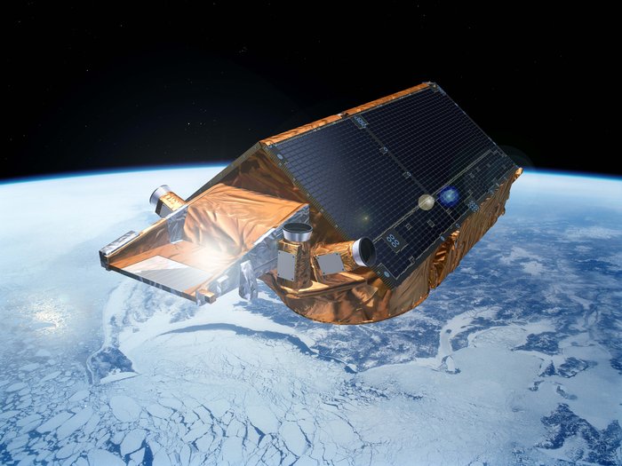
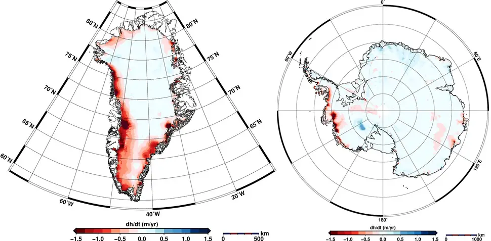
Researchers from the Alfred Wegener Institute in Germany have – for the first time – extensively mapped both Greenland’s and Antarctica’s ice sheets using the recently launched ESA satellite CryoSat-2. This new data shows that the ice crusts of these regions are declining at a rate never seen before. Elevation changes were calculated from a high-precision altimeter, using 200 million data points for Antarctica and 14.3 million for Greenland. The loss of ice volume since 2009 was found to have doubled in Greenland and tripled in West Antarctica, with a combined thinning of 500 km3 (120 mi3) per year. That is equivalent to a 6cm (2.5") layer of water covering the entire surface of the contiguous United States. The areas where CryoSat-2 found the biggest elevation changes were Jakobshavn Glacier in West Greenland and Pine Island Glacier in West Antarctica. Since February 2014, scientists have known that the Jakobshavn Glacier is collapsing into the ocean at a record rate of 46 m/day. The Pine Island Glacier hit the headlines in July 2013, when a table iceberg the size of Hamburg was seen breaking off the tip of its ice shelf. The Western Antarctic is rapidly losing ice volume – but East Antarctica is gaining volume, an argument frequently put forward by climate sceptics. However, this small increase occurring in the east is nowhere near enough to compensate the huge losses on the other side of the continent, as the map shows below.
Maps of elevation changes in Greenland (left) and Antarctica (right). Red shows ice losses, while blue shows ice gains.
These latest findings, published in the 20th August issue of The Cryosphere, will add to concerns that future sea levels may be underestimated by the Intergovernmental Panel on Climate Change (IPCC). A survey by the Vision Prize – which provides impartial and independent polling of experts on important scientific issues – has found a majority of expert respondents believe that future sea levels will be at the upper end of the IPCC's projections. New research in Nature Geoscience recently showed how Greenland is far more vulnerable to warming ocean waters than had previously been thought, with NASA glaciologist Eric Rignot stating that "the globe's ice sheets will contribute far more to sea level rise than current projections show." In fact the West Antarctic Ice Sheet has now begun an "irreversible" process of collapse which has "passed the point of no return" according to NASA. It is also worth noting that the so-called warming pause can be explained by missing heat data in the polar regions, the Arctic for example having warmed roughly eight times faster than the rest of the planet. There is certainly no hiatus when looking at extreme high temperature records. This has grave implications for the future. Low-lying regions such as Bangladesh, the Maldives and Kivalina will be among the first places to be affected, followed by Bangkok, then major Western cities by the 2050s and 2060s, resulting in massive geoengineering projects. Because of the delayed reaction from these interventions, the crisis will likely continue into the 2070s and possibly beyond. If society collapses and the mitigation efforts fail, sea levels could ultimately rise 66 metres (216 ft) by 7000 AD.
Comments »
|